
We are sorry, there are no reviews yet for this tour.
The Last Frontier (10 Days)
A Unique settlement in the northern frontiers!
Nomung, situated 125 km north of Putao at an altitude of 1640 ft, 500 meters above sea is the centre for the area in terms of administration, health care and education in remote region. Nomung Township probably is one of the most sparsely populated areas in Asia having two people per square mile ratio. You will witness heavily forested jungle with rich flora and fauna. Being depot of botany in northern Myanmar having a huge range of flowers including Rhododendron Dendricoala and many deferent species of Begonias etc., This is the very place that well-known botanist Frank Kingdon Ward has found many rare species of orchids during his botanic survey in 1920s.
Day 01 : Arrival – Putao
Upon arrival at Putao airport we will be met by our representative and transferred to our lodge. Putao lies in a valley, jumping-off point for trekkers who want to explore the region’s deep forests, wildlife sanctuaries and snow-capped mountains etc. After a brief fresh up take a walk around Putao for the orientation. Dinner and overnight at Putao Lodge.
Day 02 : Putao – Kanugmulone – Pansat
Early in the morning we visit attractive market often busy with local ethnic tribes. Return to hotel, breakfast and depart by jeep/truck through the vast Putao plain on pebbled road toward Htawadum (8 mile, one hour). Here we cross Malikha river by newly build suspension bridge and continue travel to Kaungmulone Pagoda site, said to be one of the 84000 pagodas built by Thiri Dhamma Thawka, the great king. From here we head toward north and walk to Pansat, located at 1312 feet above sea (8 mile, approx. 4 hour). We pass small villages such as Ngwa Saga, Nam Buyan, Zu Ka and Mano crossing several suspension bridges. Pansat, predominantly Rawan tribal village parched by the Malikha River under beautiful Namhti Mountain range. Dinner and overnight at local home.
Day 03 : Pansat – Camp I
Breakfast and we head north-east towards mountains to our today destination of so-called camp I (9 mile, approx. 5 hour). Our trek goes through valley along the creek and relatively easy compare to some of the trek we have done. Tonight we will pitch our own tent as there is no guest house available at this camp. Dinner and overnight at camp.
Day 04 : Camp I – Mt. Camp (elevation 2756 feet to 5361 feet then to 3340 feet)
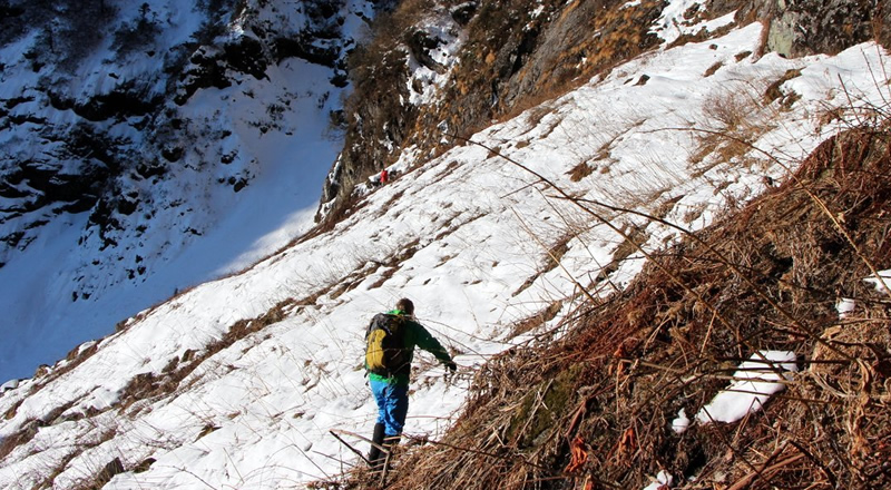
Breakfast and we head east for our destination camp II. At soon as we left camp trail goes straight uphill till we get to so-called Mt. Top (6 mile, approx. 4 hour) which is 5545 feet above sea. From here we witness snowcapped mountain in the far-east towards China border. After encounter a so-called challenge zone which comprise of a cliff cross using with a rope but from here trail goes genially down all the way to Mountain Camp
Located at 3340 feet (4 mile, approx. 2 hour). Here we pitch our tent for the first night. Dinner and overnight in tents.
Day 05 : Mt. Camp – Htonlardum (elevation 3340 feet to 2001 feet then to 2264 feet)
As usual we get up in the morning along with the bird’s call. Breakfast and we trek through the valley to the joint stream at Phandum (3 mile, approx. 2 hour). Here we cross a challenging river by makeshift bamboo bridge and continue our trek to our today destination at Htonlardum, located at 2264 feet above sea (3.80 mile, approx. 2 hour). Trail goes through beautiful valley fill with evergreen forests and rich grove of bamboo. We have social interaction with friendly local people. Dinner and overnight at local home.
Day 06 : Htonlardum – Nomung (elevation 2264 feet to 1640 feet)
We take an easy morning and visit around the village. After an early lunch we continue our today destination at Nomung (12½ mile, approx. 5 hour). The heritage trek goes gently on a flat yet through the grove of forests and beautiful trail. Nomung is the administrative township and situates at 1640 feet above sea. Dinner and overnight at the guesthouse provided by the Wildlife Conservation under Forestry Department.
Day 07 : Nomung – Maza (elevation 1830 feet to 3183 feet)
Breakfast and we have had a relaxing morning in Nomung. We visit small market and perhaps interaction with friendly people around. After an early lunch we head west and trek to Maza, locates at 3183 feet above sea (9 mile, approx. 5 hour). As soon as we leave Nomung we have to cross Kasan Creek by suspension bridge. From then we trek along the smaller creek along with bamboo grove and open paddy field till we get to the bottom of a small mountain. The trail goes up hill all the way and we witness vegetation changing as elevation change. Dinner and overnight at guest house provided by Construction Company.
Day 08 : Maza – Namti (elevation 3183 feet to 6824 feet then to 2887 feet)
Breakfast and we turn our direction to south-west towards Namti, situate at 2887 feet above sea (10½ mile, approx. 7 hour). First 4 mile or so will be uphill towards the shoulder of Mt. Babulonhtan (locally known as Noingum) at 6824 feet above sea, by winding route through its top. Along the way we witness different species of orchid along with birds. On a clear day we enjoy a spectacular view of snowcapped Mountains in the far north. This is the very place that well-known botanist Frank Kingdon Ward has found many rare species of orchids during his botanic survey in 1920. Some of the rare orchids such as Phiopedilum Wadii or Cypripedium Wardlamon (generally known as black orchid) has been named after the founder believe can only be seen in Myanmar. Beside black orchid there are many different species of orchids can be found here such as Indrovian, Clanthi, Simpidium, and Simpripedium etc. Noiwinlit and Babulonhtan valley actually is the depot of botany in northern Myanmar having a huge range of flowers. Once we climb on Noiwinlit Mt. 3278 feet, we see snake like crawling Namti creek down in the bottom of valley. Dinner and overnight at camp provided by the Construction Company.
Day 09 : Namhti – Namsabum – Putao (elevation 880 meter to 574 meter)
Breakfast and we keep trek through winding mule trek to Namsabum, locates at 574 meter above sea (16.4km, approx. 6 hour). Once we cross Htikha creek by a suspension bridge the trek goes through gently up hills and then to downhill all the way to Namsabum. On the way we witness heavily forested jungle and groups of monkeys jumping around making loud noise. Here we meet our await jeep and travel back to Putao after crossing Malikha bridge by suspension bridge. Dinner and Overnight at Putao Lodge.
Day 10 : Departure
Breakfast and perhaps a last-minute shopping at Putao market and further visit in and around Putao with suggestion by our guide. Lunch and we afternoon transfer to airport for our onward departure flight to conclude this unique experience.
SERVICE INCLUDE:
- Ground transport (coach, jeep, boat)
- Accommodation (lodge, local home stay & village house)
- Escorted English language leader, cook & porters
- Full board meal, safe drinking water
- Travel permit
SERVICE EXCULDE:
- Domestic airfare
- Insurance (please refer to Terms & Conditions)
- Expenditure on personal nature such as laundry, beverages, gratitude to guides & porters etc.,
- Any cost associated with transportation of the equipment (except for personal use which is necessary for the trek)
Remark:
Although costing is based on minimum one person, Myanmar Hill Lodges reserves the right to combine to make decent group size due to shortage of trek leaders and support staff.
Available dates
Map
You must enter a tour map code in the appropriate field when editing your tour in order for it to be displayed here